


Our 21 unit town home community is conveniently located in north-central Phoenix, with easy access to shopping, transportation, and recreation. Our community borders North Mountain Preserve park and is walking distance from City of Phoenix Mountain View park.
Metrocenter Mall and I-17 are just 2 miles away, and SR-51 can be reached in just a few minutes ride to the east. Grocery stores can be found nearby at Hatcher and Cave Creek Roads, Peoria and 35th Avenues, Thunderbird Road and 7th Street, and at 19th and Northern Avenues. Our community borders North Mountain Preserve park and is walking distance from City of Phoenix Mountain View park.
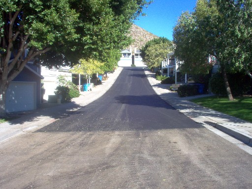
City of Phoenix seeking input on street repairs
Interactive map to suggest streets that need repairs:
Pavement maintenance - interactive map
Learn about the project at this link:
Phoenix Accelerated Pavement Mainteance Program
The City of Phoenix has recently chosen to compress the schedule at which maintenance is performed on various streets throughout the city. This strategy is funded in part by the passage of the transportation T2050 tax and aims to deliver repairs more quickly than had been previously planned.
You may have noticed several locations where curbs and sidewalks are already being worked on. Those efforts may be in preparation for coming repairs in the adjacent street.
The first phase of the accelerated repair cycle plans to compress what was previously a 3-year maintenance schedule down to about 1.5 years. This phase, already underway, will run through 2020. At that point, the streets originally planned to be maintained from 2021 to 2023 will have already been treated, and there may be resources to work on additional streets during the next phase.
This is where you come in. The city is looking for input from the people that drive the streets regularly to identify areas where maintenance may be needed. The suggested areas will then be evaluated by the city's automated condition-reporting van to determine what type of repairs would be most appropriate.
You can suggest locations using an interactive map that lets you report various roadway conditions just by placing a marker on the area you want to report. Note that some areas are already planned for various treatments. Those areas are indicated on the map in various color-coded shadings and markers. Check the map legend to see what kind of treatment each color represents.
Use this interactive map to suggest locations that need to be evaluated for repairs:
Pavement maintenance - interactive map
You can learn more about the project from publications at this link:
Phoenix Accelerated Pavement Mainteance Program
Remember, there is NO PARKING on our narrow street! City service vehicles (as well as Emergency vehicles) may not be able to navigate our street if it is congested with parked cars. Remember: the only allowed exception to the parking regulation is commercial service vehicles in the course of providing services to a unit, during normal business hours.
Our Block Watch is registered with the City of Phoenix.
You can find directions to us at GoogleMaps and on MapQwest